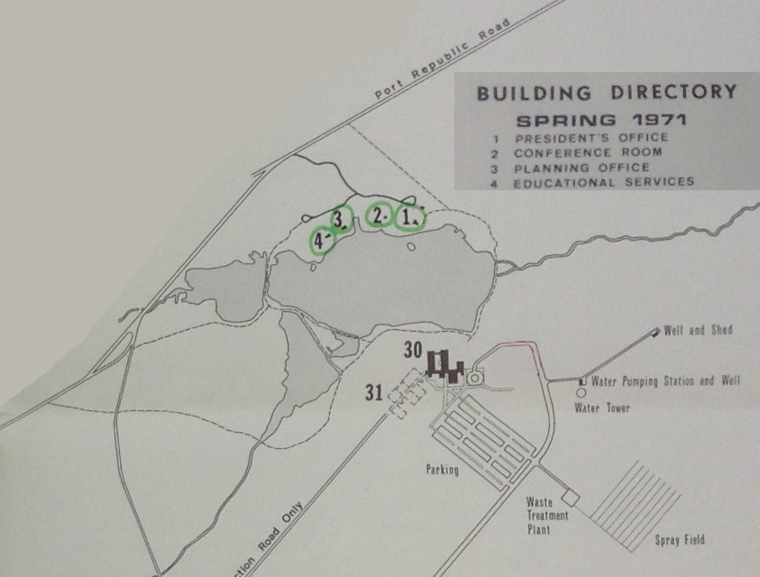
One of the goals of this blog is to identify how each cabin was used while a part of the College.
The map below, a detail from a map created for the Office of Campus Planning dated 1971, clearly identifies the cabins on the north shore. The President’s office is plain enough, but we do not entirely understand what uses cabins 2, 3, and 4 eventually entertained. We would appreciate any help in identifying which cabin held the co-op, where mass services were held, or which was the communal cabin open to bands — anything.

