Grades Pre-K, K, 1, 2
As someone who has always loved the outdoors and nature, using the National Geographic education resources is perfect for my future classroom! One resource I found was to create a map for a local park. The students will be able to understand and use spatial concepts of identity, location, and symbols.
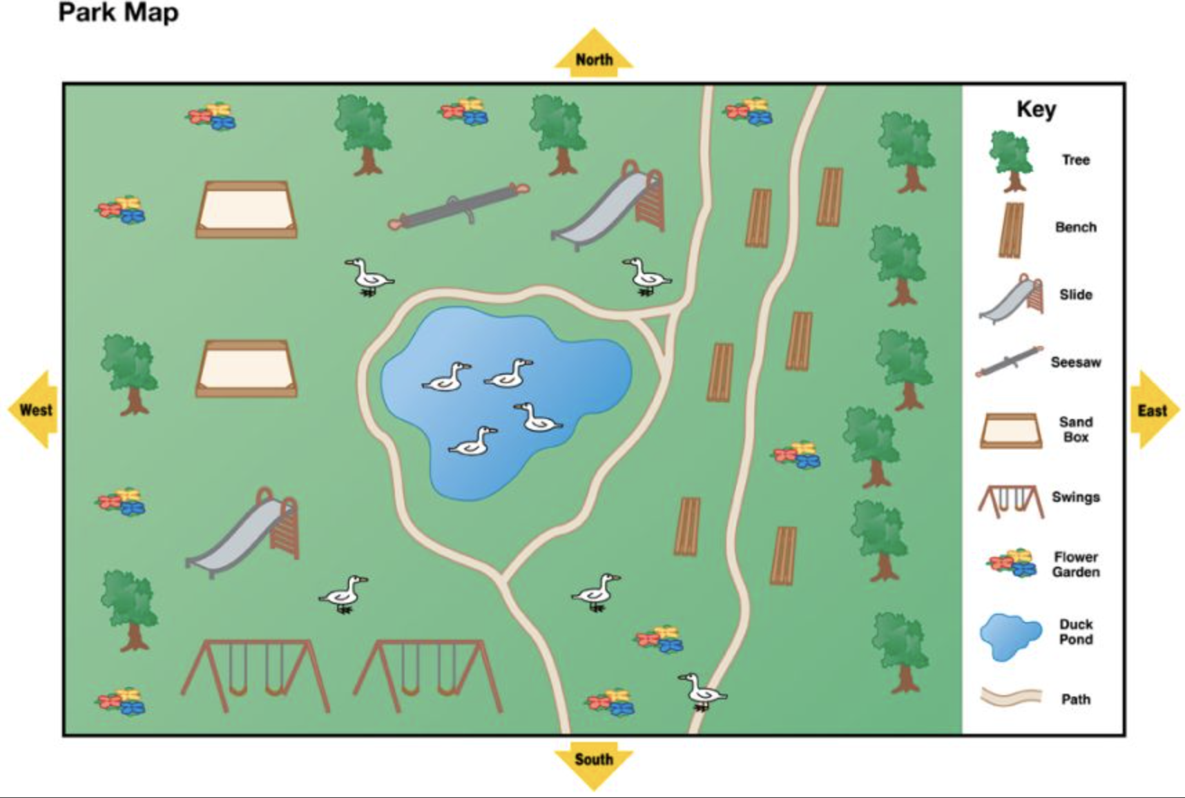
https://education.nationalgeographic.org/resource/park-map/
The first activity for the students would be to explore this already made park map. Students will be given the following prompt:
“A park is a place where people play, enjoy nature, exercise, and have fun. Look at this map of a park. It shows play areas, walking paths, and some of the nature you can find in the park. It includes a map key with symbols.
Parks provide places for people in the community and visitors to sit and enjoy nature. Look at the map key to find the symbol for a bench. Find the benches on the map. How many are there? What could you see if you sat on one and looked north, south, east, and west? What other places on the map might be a good place to enjoy nature?”
Other questions could consist of:
- What is between one of the slides and a sandbox?
- What is the line that circles the pond?
- If you were on the seesaw and looked east, what would you see?
- What are the swings next to?
- In what direction would you walk to get to the duck pond from the benches?
- If you walked south on the path, what animal might you run into?
After exploring the map as a class, students will be asked to create their own map. Including a map key with symbols. Once the map is drawn and complete, the students can show and explain their map to their classmate.
The students learn the concept of a map and how it represents places. They learn the concept of symbols, map keys, and cardinal directions for analyzation of the map.